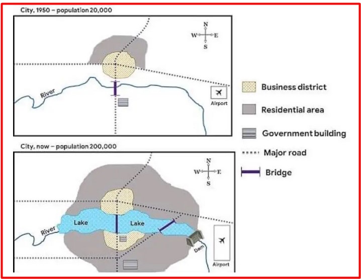
The Map of a City in 1950 and now. Summarise the information by selecting and reporting the main features, and make comparisons where relevant.
 Sample Answer of The Map of A City in 1950 and Now.
The map compares the layout of the city in 1995 with the present day.
It is clearly seen from the map that the population of the town was 20,000 in 1950. There were major roads that intersected with each other at the centre of town in the business district. On the outer side of the business district, there was a residential area on north side of the town. There was a river that flowed from west to east under the bridge, which was on one of the major roads, and that bridge was between the business district and government building. On the east side of the town, a small airport is connected with a major road.
Now the population of the city is 2,00,000, which reflects in the expansion of residential areas in every direction. In the centre of the town, the lake is introduced from west to east with a dam. The government building is now covered by the business district, and another building is constructed in the South. A new major road is built from west to east with a bridge over the lake. The airport is in the same place but bigger than in the past.
Overall, it is quite clear that there are various changes that can see in the present day, and some new things are constructed.
Follow Us on IELTSFever Facebook